Click the map or link below to go to the Garmin Connect site.
 http://connect.garmin.com/player/8590234
1. In the map image on the Garmin site, select the "Terrain" box
2. Press the "Play" button
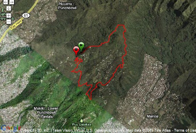
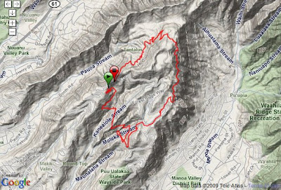
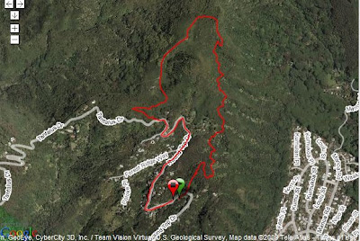
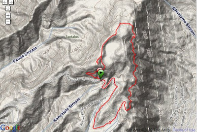
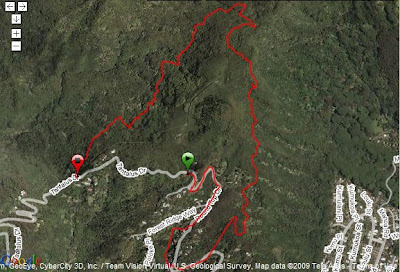
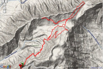
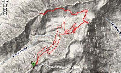
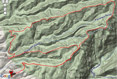
Wed, 6/17/2009
Start: Parking #2
Trails: Kalawahine - Pauoa Flats - Nuuanu - Jackass Ginger - back
2:12 / 4.6+ miles / 5149' elev. gain
We ran from Parking #2 down to the bottom of Nuuanu trail and then back up. My Garmin didn't start recording until partway into the run.
Click the map or link below to go to the Garmin Connect site.
 http://connect.garmin.com/player/7521095
1. In the map image on the Garmin site, select the "Hybrid" box
2. Press the "Play" button
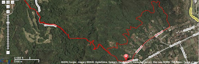
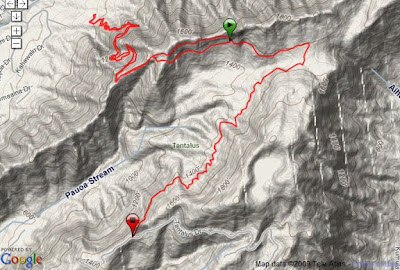
Sat, 6/20/2009
Start: Waianae Valley
4:38 / 6.8 miles / 4949' elev. gain
Mt. Kaala is the highest peak on Oahu (about 4000'). The climb is more of a hike than a run and there are great views all the way up. You can see in the map that the top of Kaala is flat. And since it's in the clouds a lot, it's kinda like a bog up there - with many unique plants.
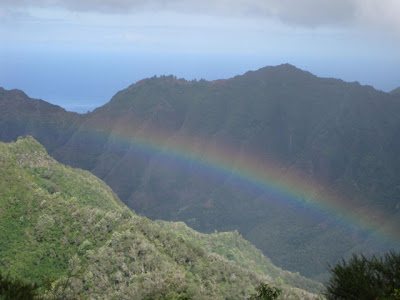 Photo by Brian Clarke
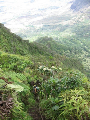 Photo by Brian Clarke
The climb has a lot of ropes, cords, garden hoses, printer cables for the steep, slippery sections.
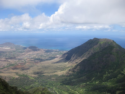 Photo by Brian Clarke
View of the Waianae valley/coast.
 Photo by Cynthia Gibson
Me, Annie, and Linda.
http://connect.garmin.com/player/85902341. In the map image on the Garmin site, select the "Terrain" box
2. Press the "Play" button
Wed, 6/17/2009
Start: Parking #2
Trails: Kalawahine - Pauoa Flats - Nuuanu - Jackass Ginger - back
2:12 / 4.6+ miles / 5149' elev. gain
We ran from Parking #2 down to the bottom of Nuuanu trail and then back up. My Garmin didn't start recording until partway into the run.
Click the map or link below to go to the Garmin Connect site.
http://connect.garmin.com/player/75210951. In the map image on the Garmin site, select the "Hybrid" box
2. Press the "Play" button
Sat, 6/20/2009
Start: Waianae Valley
4:38 / 6.8 miles / 4949' elev. gain
Mt. Kaala is the highest peak on Oahu (about 4000'). The climb is more of a hike than a run and there are great views all the way up. You can see in the map that the top of Kaala is flat. And since it's in the clouds a lot, it's kinda like a bog up there - with many unique plants.
 Photo by Brian Clarke
 Photo by Brian Clarke
The climb has a lot of ropes, cords, garden hoses, printer cables for the steep, slippery sections.
 Photo by Brian Clarke
View of the Waianae valley/coast.
 Photo by Cynthia Gibson
Me, Annie, and Linda.